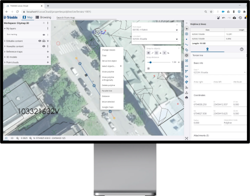
Trimble Locus is a solution for local government to manage built environment data in 3D. The solution provides all necessary tools for 3D geospatial data management and map production.
Cartographic capabilities range from detailed base maps to tourist guide maps, which can be printed or distributed through a wide range of interfaces.

3D city models
High-quality geospatial data can be maintained in both 2D and 3D views, which enables the cities to extend their base maps into up-to-date, 3D city models. Data and models from different sources can be combined and used together, e.g. GIS, BIM, InfraBIM and Lidar data. A 3D city model can be created with only one click by utilizing the buildings and terrain model produced in connection with the city base map.
When city models are enriched by information about land parcels, buildings, infrastructure and even citizen and services, a complete digital twin of the city is created. All information is managed as logical objects and the maintenance of geospatial and attribute data is possible at the same time.
Easy integration
Trimble Locus enables maintaining and viewing municipal basic registers through an integration with register data contents. The solution supports interoperability through common map formats and standard interfaces to, for example, document management and ERP systems (Enterprise Resource Planning).
Trimble Locus supports the following applications:
- Land Use Planning
- Street and Park Management
The modern interface of Trimble Locus makes working efficient. You can work whenever you want, wherever you want - as long as you have an internet connection. You can work with laptop, tablet, smart phone or any other device on different platforms that support flexible remote working.
The up-to-date and coherent data can be used everywhere via single user interface available for maintaining and sharing information. Depending on the user profile, information can be modified or it can be in read-only mode, while the user interface adjusts to the current needs.

Our cloud solution is easy to get and it decreases the IT costs of local government as there is no need for servers. As cloud solution is accessible from any device, there is no need for desktop installations either. The solution is always ready for new users and updates can be done without interruptions. The solution scales according to the usage and there is no need for extra capacity in reserve.

With Trimble Locus, it is possible to use a diverse collection of devices
and take your work mobile. The system can be opened up to partners, subcontractors and other interest groups flexibly. Third party applications can be implemented by using versatile integration possibilities. The solution upgrades to future needs and its life cycle is long-lasting.

Land use planning
Land Use Planning -application is used for creating and managing land use plans of all levels from master plans to detailed plans. Planners can effectively use information for planning from other integrated municipal registers. GIS functionalities and analyses can be easily executed to analyze environmental and other community aspects. The creation and management of parallel land use scenarios is fluent.
Plans are managed and distributed using an integrated land use register. The land use register contains all information about land use plan units, building bans, restriction areas and special resolutions.
Key benefits
- Create land use plans which consider environmental objectives and other goals set in municipal development strategies
- Improved efficiency and work ergonomics
- Improved planning work efficiency

